

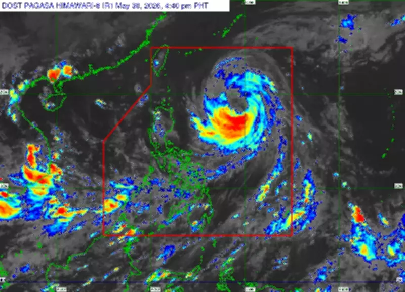
Typhoon Domeng, previously a severe tropical storm, intensified into a typhoon on Saturday, May 30, 2026, according to the Philippine Atmospheric, Geophysical and Astronomical Services Administration (Pagasa). As of 5 p.m., the typhoon's eye was located approximately 815 kilometers east of Northern Luzon.
Typhoon Domeng's Current Strength
The typhoon carries maximum sustained winds of 120 kilometers per hour near its center, with gusts reaching up to 150 kilometers per hour. Pagasa reports that Domeng is expected to move in a north-northwestward direction until May 31, after which it will recurve toward Japan for the remainder of the forecast period.
Landfall and Exit from Philippine Area of Responsibility
The weather bureau stated that Domeng is unlikely to make landfall in the Philippines. It is forecast to exit the Philippine Area of Responsibility by Monday, June 1. Despite this, the typhoon is expected to continue intensifying over the Philippine Sea, potentially reaching its peak intensity on Monday before gradually weakening. Domeng is anticipated to remain a typhoon throughout the rest of the forecast period.

Pagasa continues to monitor the typhoon's progress and advises the public to stay updated on the latest weather advisories.