The Philippine Atmospheric, Geophysical and Astronomical Services Administration (PAGASA) has raised Storm Signal No. 1 in four key areas of Cebu as Tropical Depression 'Tino' continues to move across the region.
Affected Areas Under Storm Warning
The following locations in Cebu are now under Storm Signal No. 1:
- Camotes Islands
- Bantayan Island
- Daanbantayan
- Santa Fe
Current Storm Status and Movement
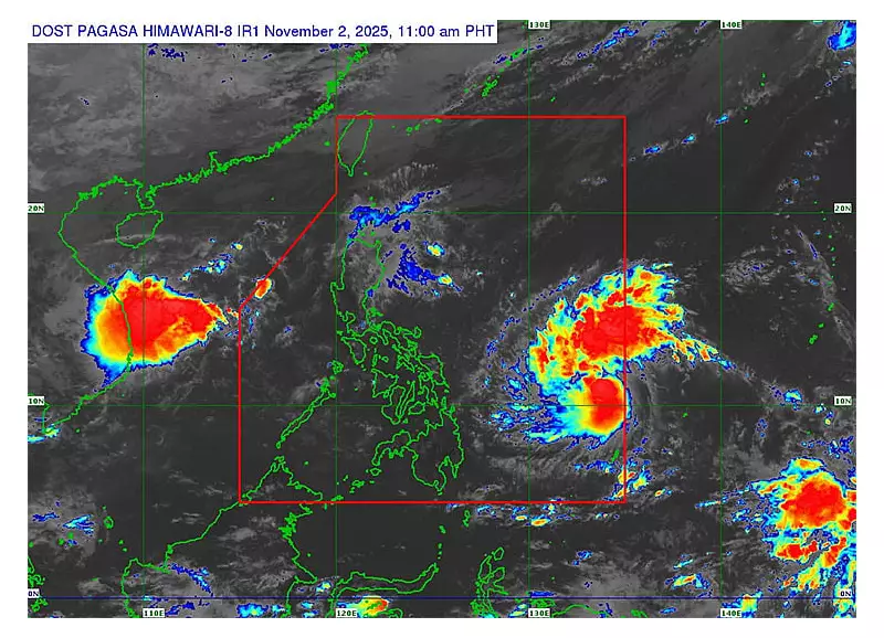
According to the latest weather bulletin from PAGASA, Tropical Depression Tino was last spotted 150 kilometers east of Guiuan, Eastern Samar. The weather disturbance is moving westward at 15 kilometers per hour, bringing moderate to heavy rainfall within its 300-kilometer diameter.

Key weather parameters include:
- Maximum sustained winds: 45 km/h near the center
- Gust strength: Up to 55 km/h
- Movement direction: Westward track
Expected Weather Impact
Residents in the affected areas should prepare for the following conditions:
Today's forecast includes:
- Cloudy skies with scattered rainshowers and thunderstorms
- Moderate to occasionally heavy rains
- Possible flooding in low-lying areas
- Landslide risks in mountainous regions
Safety Precautions and Recommendations
Local disaster risk reduction management offices are advising residents to take necessary precautions:
- Stay updated with the latest weather bulletins from PAGASA
- Avoid unnecessary travel, especially via sea routes
- Secure loose outdoor items that might be blown away by strong winds
- Prepare emergency kits and important documents
- Follow evacuation orders from local authorities if issued
The public is reminded to monitor official channels for any updates or changes in the storm signal status as Tropical Depression Tino continues its path across the Visayas region.