The Philippine Atmospheric, Geophysical and Astronomical Services Administration (PAGASA) announced on Monday that Tropical Depression (TD) Caloy is expected to weaken into a remnant low within the day. The weather bureau stated that Caloy is unlikely to directly affect the country throughout the forecast period, as it will remain far from any landmass.
Current Status of TD Caloy
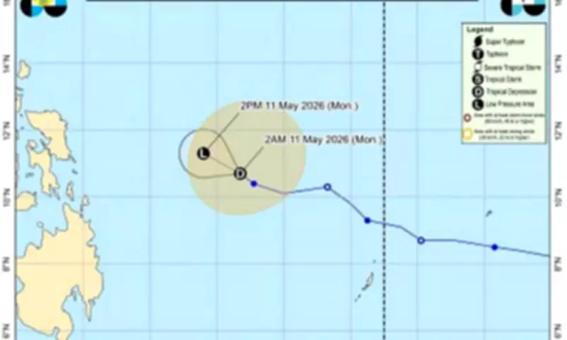
In its 5 a.m. bulletin, PAGASA reported that Caloy was last located 530 kilometers east of Guiuan, Eastern Samar. The tropical depression is packing maximum sustained winds of 45 kilometers per hour near the center, with gustiness reaching up to 55 kilometers per hour. No wind signal has been hoisted over any part of the country.
Sea Conditions and Advisory
Up to moderate seas are expected over several coastal waters, including the seaboards of Batanes, Cagayan, Isabela, Ilocos Norte, northern Ilocos Sur, Aurora, Camarines Norte, Northern Samar, Eastern Samar, and Surigao del Sur. Also affected are the western seaboard of Pangasinan; the northern seaboards of Camarines Sur; the northern and eastern seaboards of Quezon, including Polillo Islands and Catanduanes; and the eastern seaboards of Albay, Sorsogon, Eastern Samar, Dinagat Islands, Siargao-Bucas Grande Islands, and Davao Oriental.

PAGASA advised mariners of motor bancas to take precautionary measures and avoid navigation under these conditions. The public is urged to stay updated on the latest weather bulletins as the situation develops.