Urban Development Blamed for Severe Cebu City Flooding
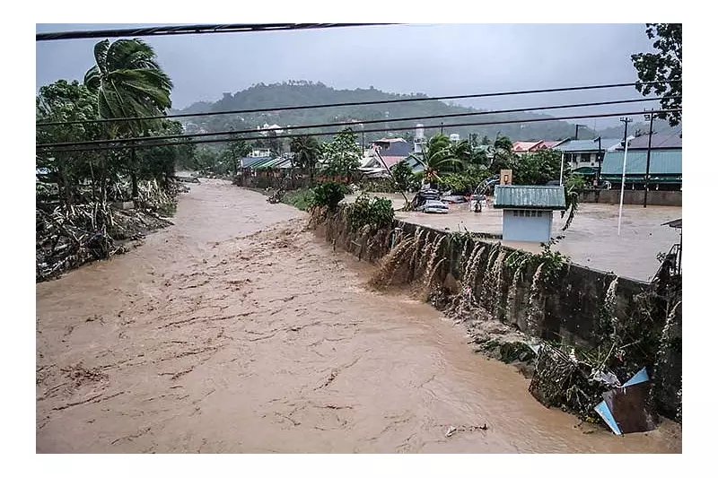
The devastating flood that swept through Barangay Bacayan in Cebu City during Typhoon Tino on November 4, 2025, was not merely a result of heavy rainfall but the consequence of decades of urbanization, deforestation, and the weakening of natural water retention systems in the city's mountain areas.
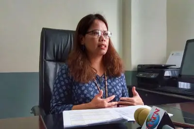
Cebu City Councilor Joel Garganera, chairman of the Committee on Environment and vice chair of the Disaster Risk Reduction and Management Council, revealed that rapid construction of subdivisions and concrete roads in mountain barangays has disrupted natural water flow and absorption patterns.
Environmental Degradation Reaches Critical Point
"The water from the mountains could no longer be absorbed by the soil, and that triggered the strong water current that hit Bacayan," Garganera stated during his interview with SunStar Cebu on Tuesday, November 4, 2025.

The councilor emphasized that the loss of trees has significantly weakened mountain communities, making them more vulnerable to flooding because the soil can no longer absorb heavy rainfall effectively. Garganera observed that Cebu City has undergone dramatic changes over the past five decades, with the problem extending beyond deforestation to include human migration into upland areas.
"If we compare the city to what it was 50 years ago, the difference is huge," he noted, pointing out that numerous subdivisions have been built in mountainous areas that were once forested landscapes that naturally absorbed rainwater.
Critical Infrastructure Deficiencies Exposed
Today, large portions of land have been cemented over, significantly worsening surface water runoff during heavy rainfall. Garganera highlighted that the city critically lacks proper water retention systems, making it increasingly difficult to manage sudden water surges during storms.
"It's not just about the loss of trees but also the migration of people who have settled in the uplands," the official explained. "We don't have any water retention at all, sad to say."
The councilor further noted that both informal settlers and major establishments have encroached upon the city's natural waterways, causing rivers to gradually narrow over time and reducing their capacity to handle floodwaters.
Watershed System Under Pressure
While some residents blamed flooding on water originating from Barangay Lusaran, a distant mountain barangay, Garganera clarified that singling out Lusaran would be unfair. He explained that although Lusaran falls within Cebu City's upland watershed system, its water doesn't directly affect the Butuanon River.
Barangay Lusaran hosts the Lusaran Watershed, one of the city's primary water catchment areas, and the Lusaran Dam, which helps supply water to the metropolitan system. During heavy rainfall, the elevated terrain of Lusaran and neighboring mountain barangays naturally causes rapid water flow downward, contributing to significant water volume flowing into the Butuanon River.
When this runoff combines with already swollen waterways, lower-lying areas like Bacayan bear the brunt of flooding. This explains why downstream communities such as Bacayan experienced such severe flooding during Typhoon Tino.
"We should start restoring our waterways and prohibit people from living along riverbanks," Garganera urged. "The volume of water we're seeing now is no longer normal."
The official's statements highlight an urgent need for comprehensive environmental planning and watershed restoration to prevent similar disasters in Cebu City's future.