
Weather Bureau Closely Monitors Low Pressure Area With High Cyclone Potential
The Philippine Atmospheric, Geophysical and Astronomical Services Administration (Pagasa) issued a significant weather advisory on Tuesday, indicating that a low pressure area (LPA) located outside the Philippine Area of Responsibility (PAR) has a substantial probability of intensifying into a tropical cyclone within the next 24 hours. This developing weather system poses potential impacts for several regions, particularly in Mindanao.
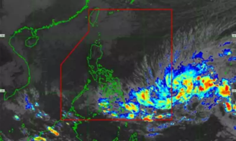
Current Location and Movement of the Weather Disturbance
As of 2 a.m. on Tuesday, meteorological data placed the LPA approximately 1,370 kilometers east of Northeastern Mindanao. Pagasa forecaster Chenel Dominguez reported that the weather disturbance is under close observation as it continues its westward trajectory, showing clear indications of possible strengthening. The LPA is also forecast to enter PAR today, Dominguez stated, which could provide more favorable conditions for further development.
Potential Development into Tropical Cyclone Basyang
Once the system crosses into the Philippine Area of Responsibility, environmental factors such as warm sea surface temperatures and low wind shear may facilitate its intensification. Should it achieve tropical cyclone status, it will be assigned the local name Basyang. Dominguez emphasized that this potential cyclone could generate enhanced rainfall and gusty winds, potentially affecting parts of the Visayas and Mindanao in the coming days.

Immediate Weather Impacts Across the Philippines
Even without full tropical cyclone development, the prevailing shear line is expected to bring wet conditions to large portions of the archipelago. Pagasa has forecast:
- Scattered rains and isolated thunderstorms across the Visayas, Caraga, Davao Region, and Misamis Oriental
- Moderate to heavy rainfall in these areas, which may result in flash floods or landslides, especially in low-lying and mountainous terrain
- Unsettled weather in the remainder of Mindanao, with localized thunderstorms likely to trigger brief but intense rain showers during afternoon and evening hours
In Northern Luzon, the northeast monsoon or amihan will continue to influence weather patterns, bringing light rains over the Batanes and Babuyan Islands and isolated light rains over the rest of Luzon.
Wind and Marine Conditions Advisory
Pagasa also warned that windy conditions will prevail in several regions. The forecast includes:
- Moderate to strong winds over Northern Luzon and the eastern sections of Central and Southern Luzon
- Similar wind conditions in portions of the Visayas and Mindanao
- These winds may lead to moderate to rough sea conditions, posing navigation risks to small fishing boats and other sea vessels
In other areas, winds will generally be light to moderate, with coastal waters remaining slight to moderate. The weather bureau strongly advised the public, particularly those in coastal communities and disaster-prone areas, to maintain vigilance and continuously monitor official weather advisories as conditions may change rapidly.